Parks, paths and recreation
Explore community rinks, the South March Highlands trail network and nearby indoor recreation.
26 parks, trails, recreation centres and libraries are mapped in the Morgan's Grant area from OpenStreetMap, each linked to its source.
Updated · Facts on this page link to their sources
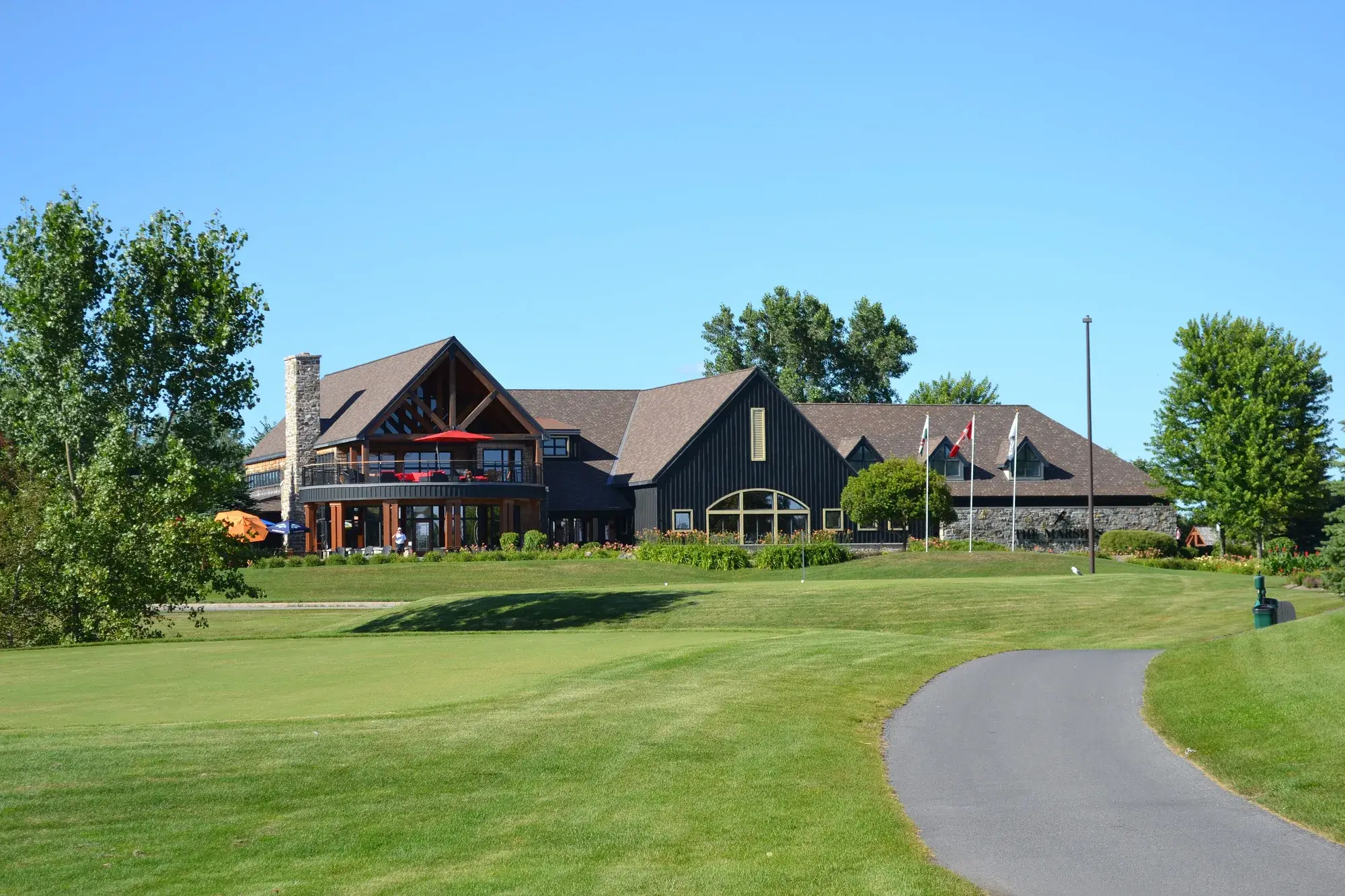
The City identifies the Klondike Road and Second Line Road intersection as a South March Highlands access point. Richcraft has pools, gymnasiums and outdoor recreation facilities, while the community association supports seasonal outdoor rinks at W.C. Bowes and Morgan’s Grant.
Parks, trails and recreation
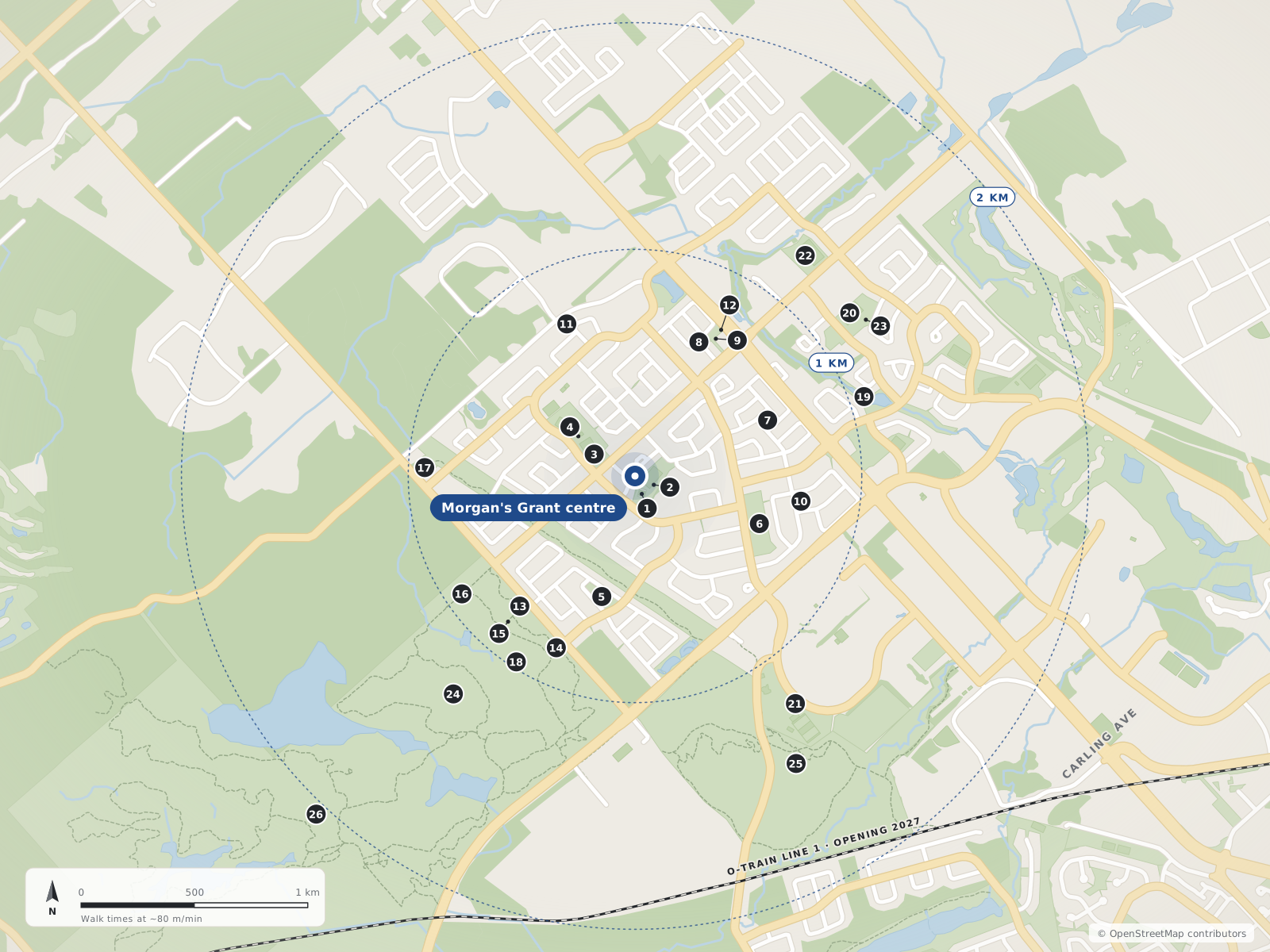
- 1Klondike Road Park Ice Rink90 m
- 2Klondike Road Park90 m
- 3W.C. Bowes Park Ice Rink210 m
- 4W.C. Bowes Park310 m
- 5Forestbrook Park550 m
- 6Morgan's Grant Woods Park590 m
- 7Gateshead Park630 m
- 8Weatherston Street Park680 m
- 9Old March Town Hall Park710 m
- 10Allenby Park740 m
- 11Dunollie Park740 m
- 12Old March Town Hall750 m
- 13Coconut Tree 🟢790 m
- 14Brady840 m
- 15Forest Brook 🟢850 m
- 16Klondike 🟢920 m
- 17Louis Turner Park930 m
- 18Beartree 🟢980 m
- 19Shirley's Brook Park1.1 km
- 20Juanita Snelgrove Park1.2 km
- 21Richcraft Recreation Complex1.2 km
- 22Brookshire Park1.2 km
- 23Juanita Snelgrove Park Ice Rink1.2 km
- 24Rockhopper 🟦1.2 km
- 25Monk Environmental Park1.5 km
- 26South March Highlands Conservation Forest2.0 km
Pathways & trails
6Brady
In Morgan's Grantopenstreetmap.org
Coconut Tree 🟢
In Morgan's Grantopenstreetmap.org
Forest Brook 🟢
In Morgan's Grantopenstreetmap.org
Beartree 🟢
Klondike 🟢
Rockhopper 🟦
Neighbourhood parks
16Allenby Park
In Morgan's Grantopenstreetmap.org
Dunollie Park
In Morgan's Grantopenstreetmap.org
Forestbrook Park
In Morgan's Grantopenstreetmap.org
Gateshead Park
In Morgan's Grantopenstreetmap.org
Klondike Road Park
In Morgan's Grantopenstreetmap.org
Louis Turner Park
In Morgan's Grantopenstreetmap.org
Morgan's Grant Woods Park
In Morgan's Grantopenstreetmap.org
Old March Town Hall Park
In Morgan's Grantopenstreetmap.org
W.C. Bowes Park
In Morgan's Grantopenstreetmap.org
Weatherston Street Park
In Morgan's Grantopenstreetmap.org
Brookshire Park
Juanita Snelgrove Park
Monk Environmental Park
Richcraft Recreation Complex
Shirley's Brook Park
South March Highlands Conservation Forest
Recreation centres & libraries
4Klondike Road Park Ice Rink
In Morgan's Grantopenstreetmap.org
Old March Town Hall
In Morgan's Grantopenstreetmap.org
W.C. Bowes Park Ice Rink
In Morgan's Grantopenstreetmap.org
Juanita Snelgrove Park Ice Rink
Quick answers
Short answers first; each links to the full answer and its sources.
Which local parks appear in community activities?
W.C. Bowes Park and Morgan’s Grant Woods are named in the community association’s 2026 Cleaning the Capital event. That event identifies Morgan’s Grant Woods at 50 Flamborough Way and a W.C. Bowes meeting point at the Klondike entrance.
As of 2026-10-30 · bmgcakanata.ca
Where can I access South March Highlands trails?
The City identifies an access point at Klondike Road and Second Line Road. Its South March Highlands guide describes hiking, skiing, snowshoeing and other recreation in woodland, wetland and rocky terrain.
As of 2026-10-30 · ottawa.ca
Are there outdoor community skating rinks?
The community association lists Morgan’s Grant’s Klondike rink at 1383 Halton Terrace and the W.C. Bowes rink at 1251 Halton Terrace. Volunteers operate these outdoor rinks with City support.
As of 2026-10-30 · bmgcakanata.ca
Where can residents swim or use indoor recreation facilities?
Richcraft Recreation Complex–Kanata is at 4101 Innovation Drive. The City lists swimming pools, gymnasiums and fitness facilities, along with outdoor recreation amenities.
As of 2026-10-30 · ottawa.ca
What is mountain biking like at South March Highlands?
The Ottawa Mountain Bike Association describes South March Highlands as technical terrain with rock features, bridges and challenging sections. Its trail guidance also identifies seasonal closures and asks riders to respect trail conditions.
As of 2026-10-30 · ottawamba.org
Can you walk around Morgan’s Grant using local paths?
A paved municipal path runs through the hydro corridor, linking local streets and wider recreation and transport connections. The 2022 community study describes a corridor from Terry Fox Drive towards Old Carp Road; this does not establish a walking time from every home to shops or schools.
As of 2026-10-30 · ottawastewardship.org